SURVEYING — DOCUMENTATION — DIGITISATION OF ARCHITECTURE

From real-world data to the project.

We acquire, analyse and reproduce architecture using advanced digital surveying technologies. We turn millions of points into reliable technical drawings ready for design work: plans, sections, elevations, 3D models and high-precision metric documentation.

Every project follows a defined and verifiable process, from acquisition through to final delivery. Precision, tolerance control and data traceability are at the centre of our method.

Get in touch Our services
BY THE NUMBERS
2015

Specialists in digital surveying.

10+

Years of experience.

500+

International projects.

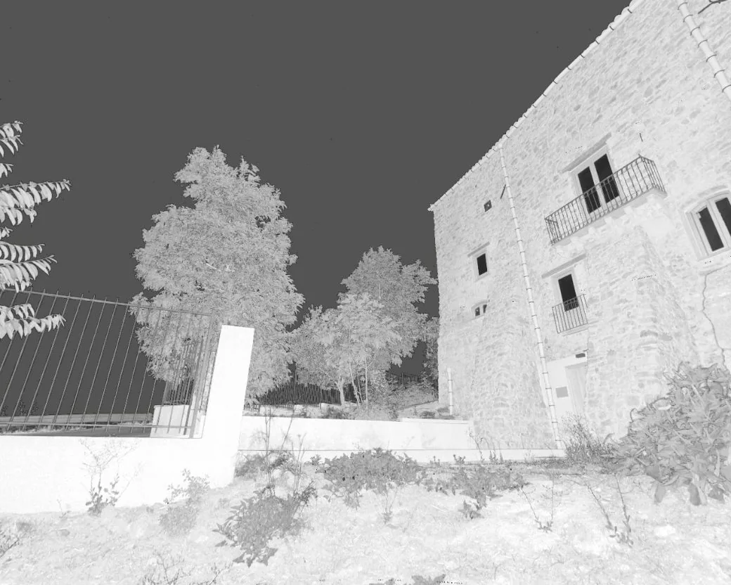
Nuvola di punti da rilievo laser scanner di un edificio storico in pietra

WHAT WE DO

Digital surveying of architecture

We carry out laser scanner, photogrammetric and topographic surveys of buildings, historic complexes and architectural contexts. We produce georeferenced technical drawings with stated tolerances and complete documentation of the existing fabric, supporting design, restoration and conservation.

Services
  • 3D laser scanner surveys
  • Topographic and georeferenced surveys
  • Terrestrial and drone photogrammetry
  • High-density point clouds
  • Surveys of historic and listed buildings
  • Architectural surveys, interior and exterior
  • Surveys for restoration and conservation
  • As-built documentation
  • Tolerance checking and verification

2D drawings and 3D modelling

We turn survey data into plans, sections, elevations, three-dimensional models and technical representations suited to each stage of the project. Every drawing is built from real-world data, guaranteeing geometric consistency and metric precision.

Services
  • Dimensioned plans, sections and elevations
  • 2D CAD drawings (DWG)
  • Three-dimensional modelling of existing fabric
  • 3D models for architecture and restoration
  • Orthophotos and photorealistic elevations
  • Reproduction of architectural details
  • Technical drawings for design practices
  • Modelling of architectural complexes
  • Support for technical documentation

Virtual tours and immersive documentation

We produce navigable virtual tours and 360° photographic documentation so spaces can be consulted remotely. A useful tool for designers, clients and project teams who need to check details, coordinate work or document the state of a place over time.

Services
  • 360° virtual tours
  • Immersive photographic documentation
  • Remote inspections
  • Monitoring of works in progress
  • Navigable digital archives
  • Documentation for heritage sites and museums
  • Online sharing of surveyed spaces
  • Enhancement of architectural heritage
  • Digitisation of historic buildings

Laser scanner 3D su treppiede durante un rilievo in cantiere
HOW WE WORK

Precision, method and control of the data.

Every job starts from a structured working process that lets us guarantee accuracy, consistency and traceability at every stage of acquisition and delivery.

From the field survey to the delivery of the final drawings, data is acquired, verified and turned into technical documentation ready to be used by designers, contractors and public bodies. Every element represented derives from measurable, checked information, ensuring maximum reliability of the result.

We do not treat the survey as a simple preliminary step, but as the base of knowledge on which every subsequent activity of analysis, design, restoration and enhancement of architecture is built.

Our aim is to provide a faithful, verifiable representation of the built fabric, turning millions of data points gathered on site into concrete tools for understanding, documenting and preserving architectural heritage.

Let's talk about your project.

Contact us